Day 37 – 33.2 km – Sunday 02.06.2024
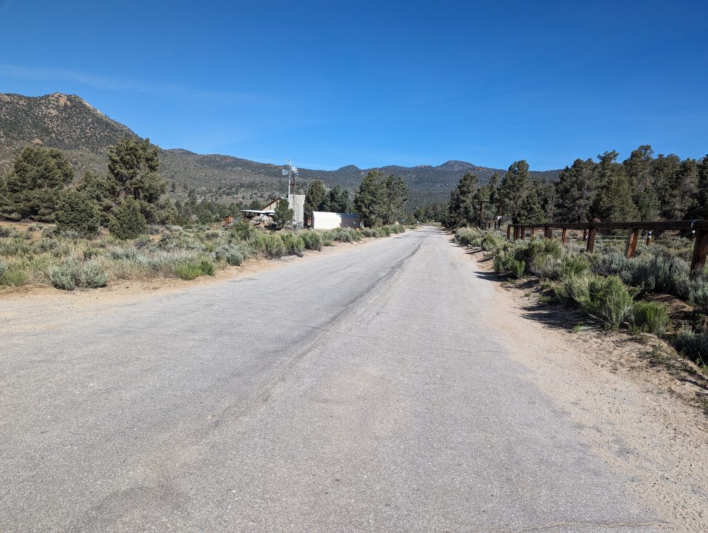
I get up at half past seven and make my way to the terrace, where breakfast is served again today. But since you can only order food from 7, I have to go to other people who are already awake. After all, there is already good coffee and the time will quickly pass conversations. Even today I have blueberry pancakes with potato rösti, scrambled eggs and a meatball again. The pancakes are again very big, but thanks to my extensive hunger, I eat them in a few minutes. After another coffee, I’ll leave you other hikers, dismantle my tent and pack everything up. Surprisingly, my backpack is lighter than expected. Despite the additional weight of the bear canister, the ice axe and the microspikes, which is more than two kilos in total, I can still carry the backpack well. Since I will probably have permanent access to water in the next few weeks, I can at least save myself heavy water transport and should therefore have a similar weight as in the desert. After talking to some people again, I say goodbye to them and set off again shortly before 9 a.m.
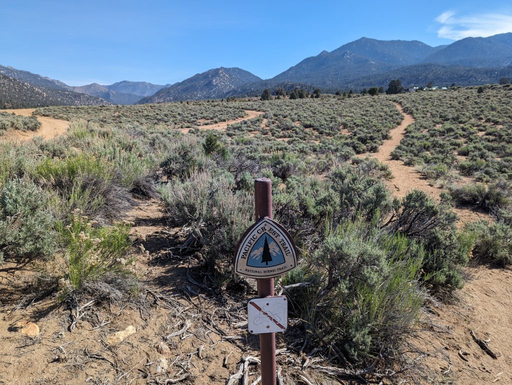
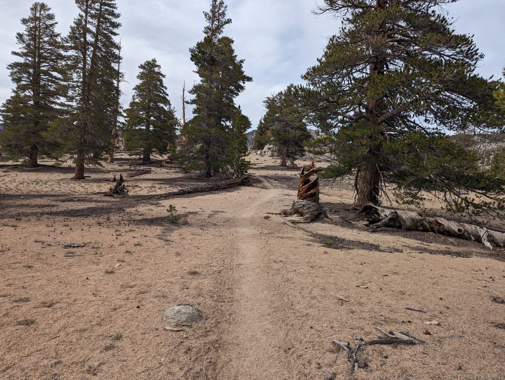
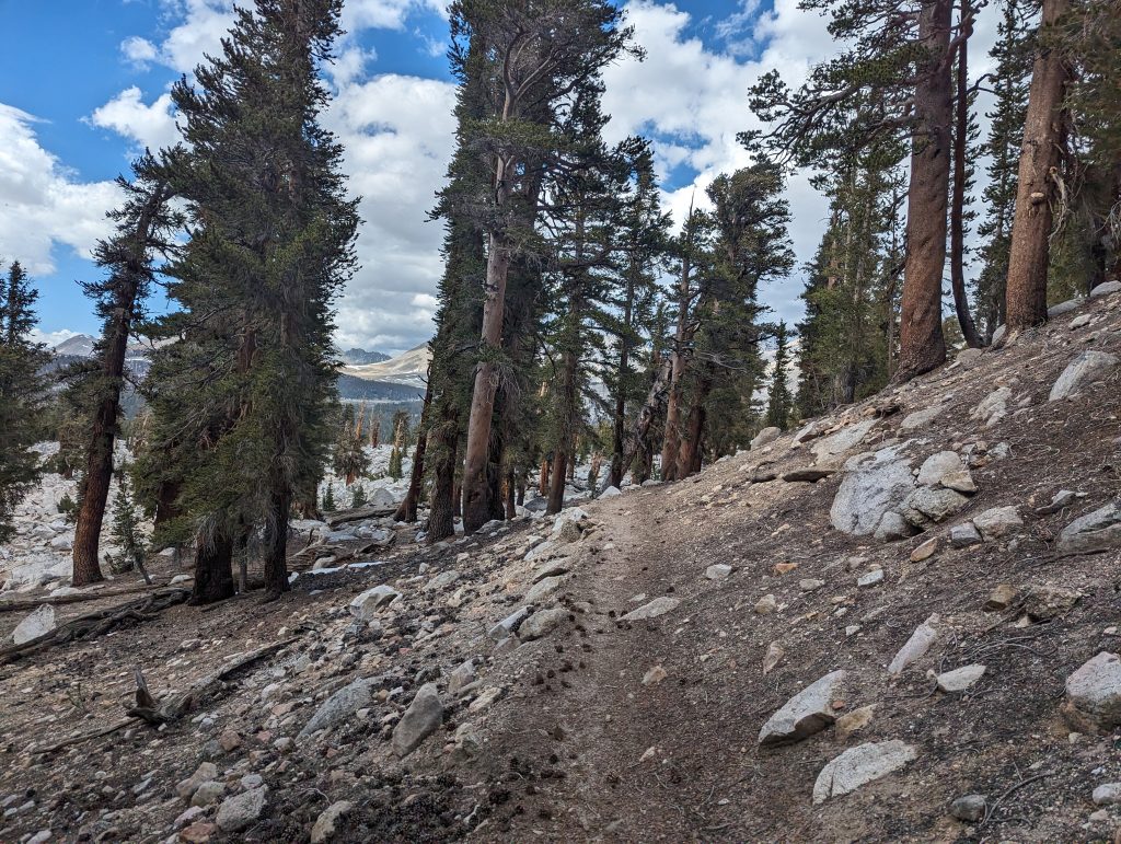
After yesterday’s break day, I feel very rested today and therefore start right away. After a short section on the road, I reach the PCT again and it goes through a green environment towards the mountains.
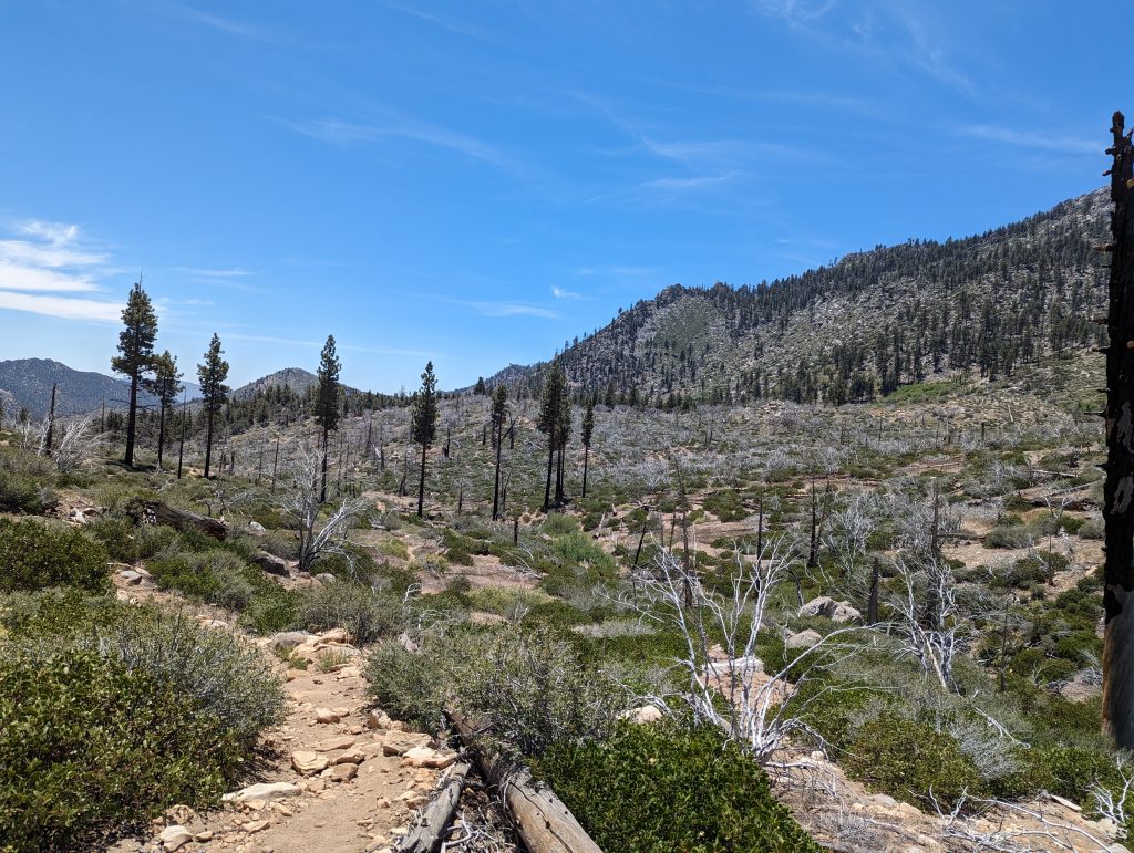
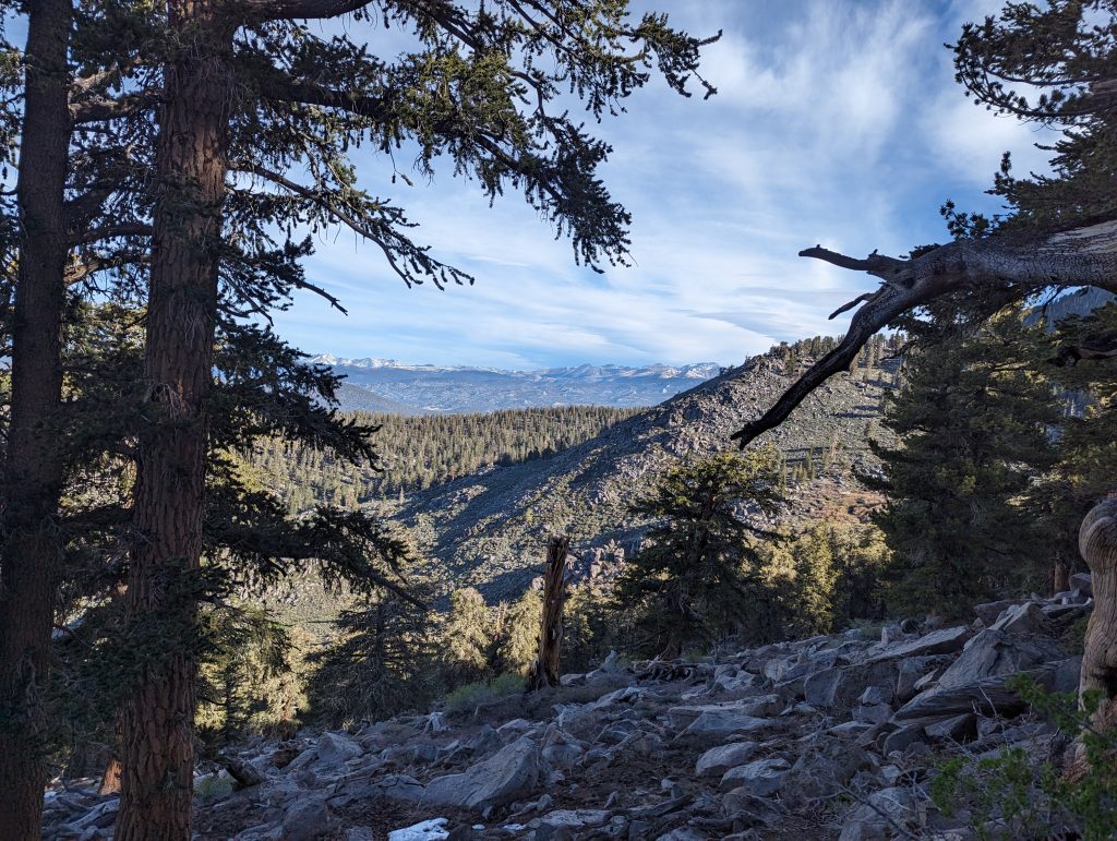
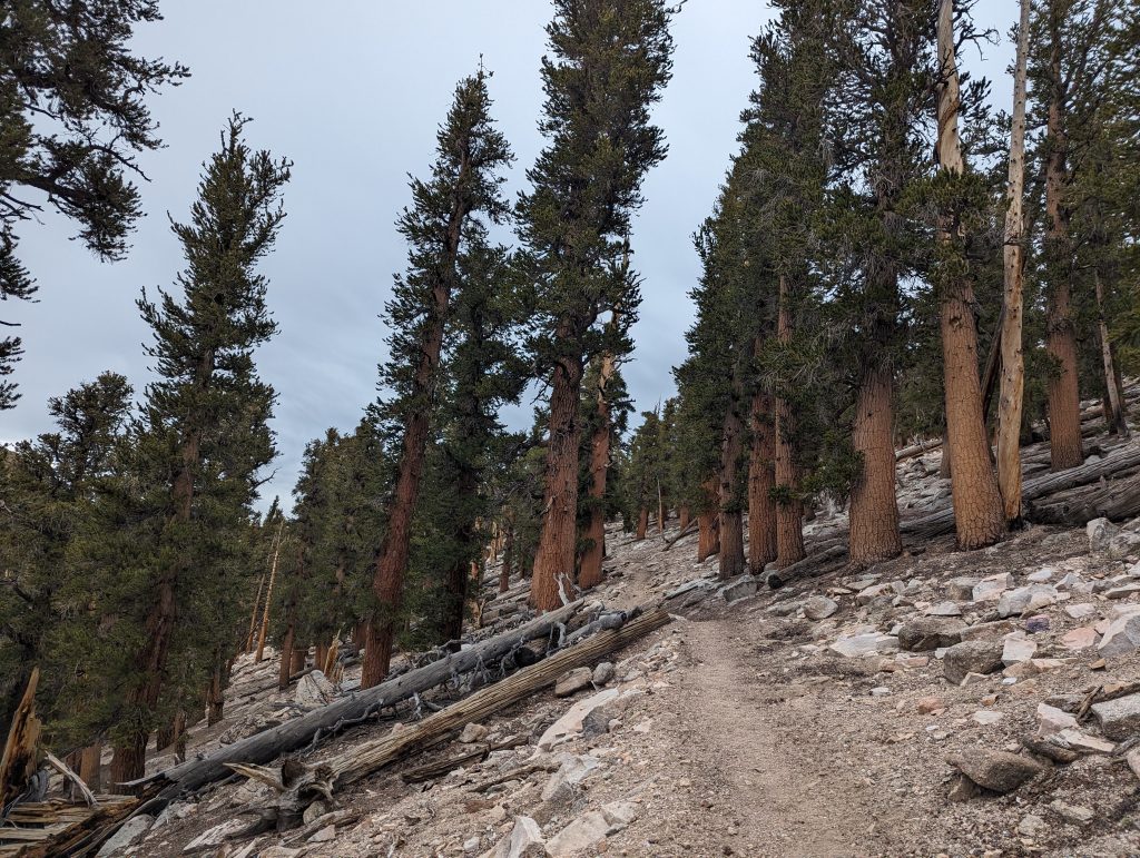
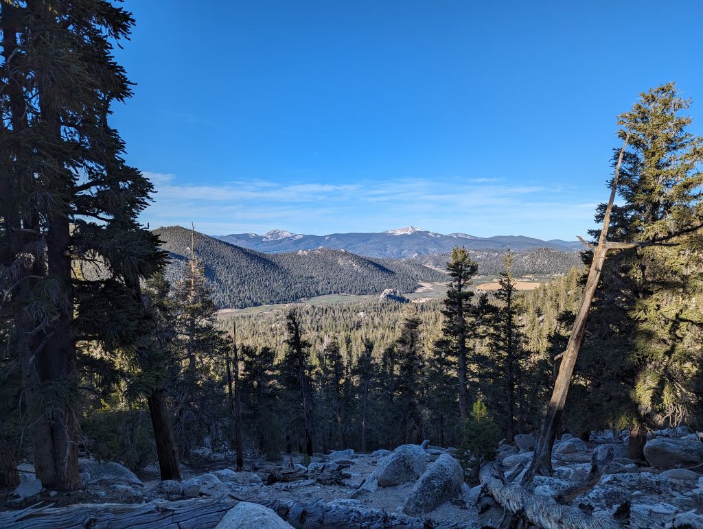
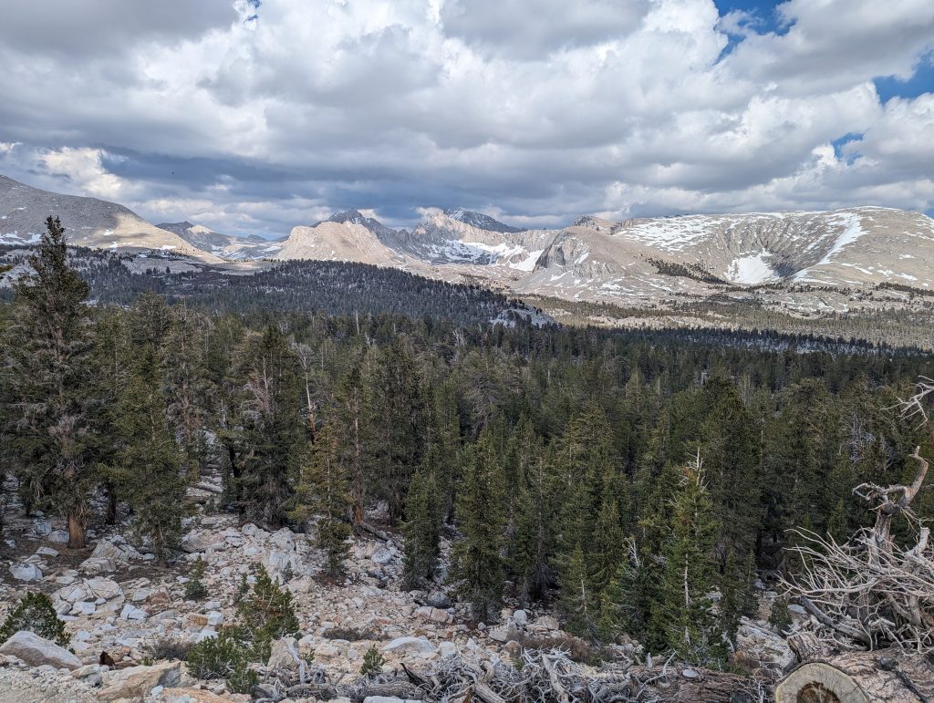
After a short time it goes uphill and I quickly gain altitude. Even if I can’t enjoy a view yet, I notice the huge difference to the last few weeks. I hike through beautiful forests with colorful flowers along a mountain river and further up.
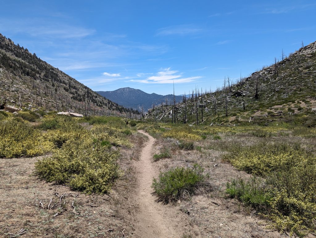
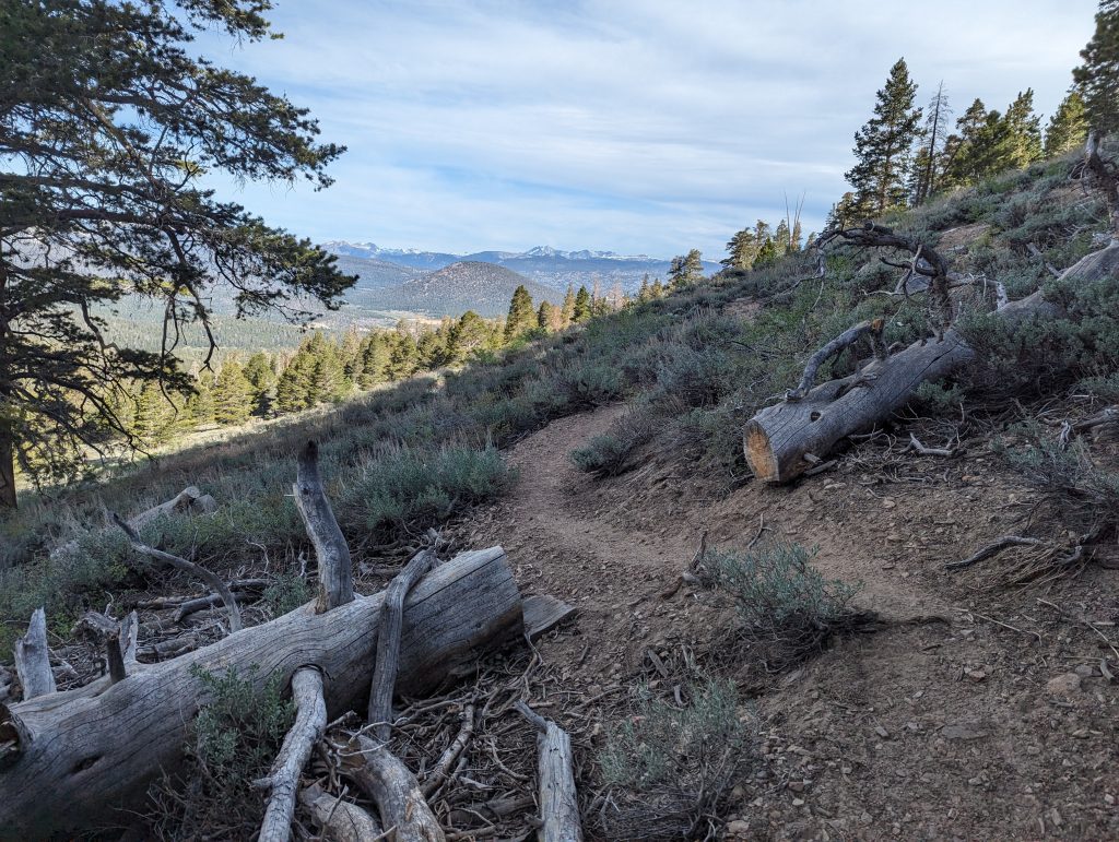
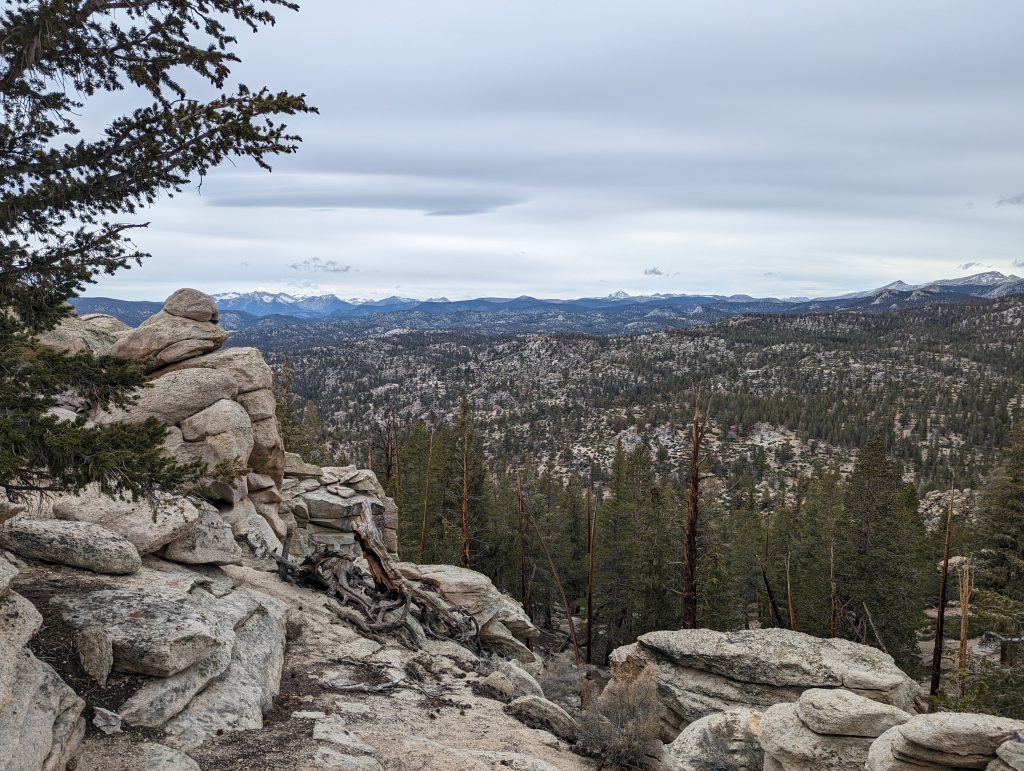
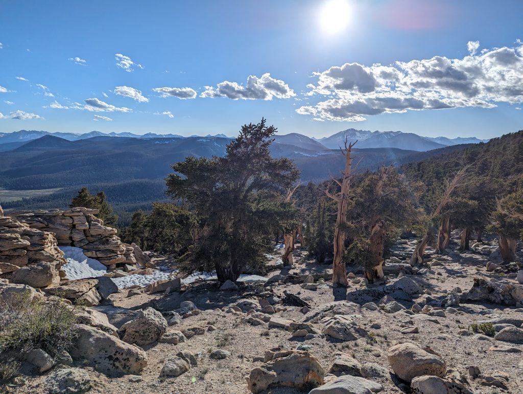
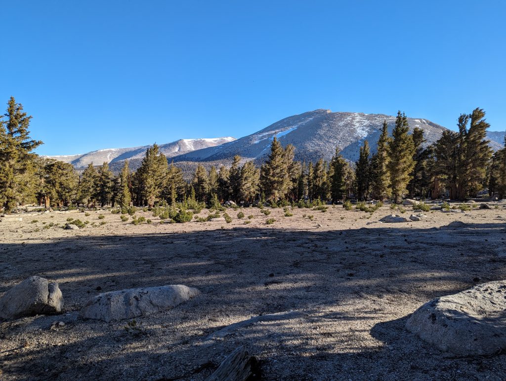
After a pass, I don’t get a hoped-for view into the distance, but at least I’m on a plateau and can see some mountains in front of me, on which there is even some snow. The landscape looks really fantastic and in contrast to the barren last few weeks, the green environment looks much more lively. The temperatures are also pleasant and so I can continue to gain altitude without much effort.
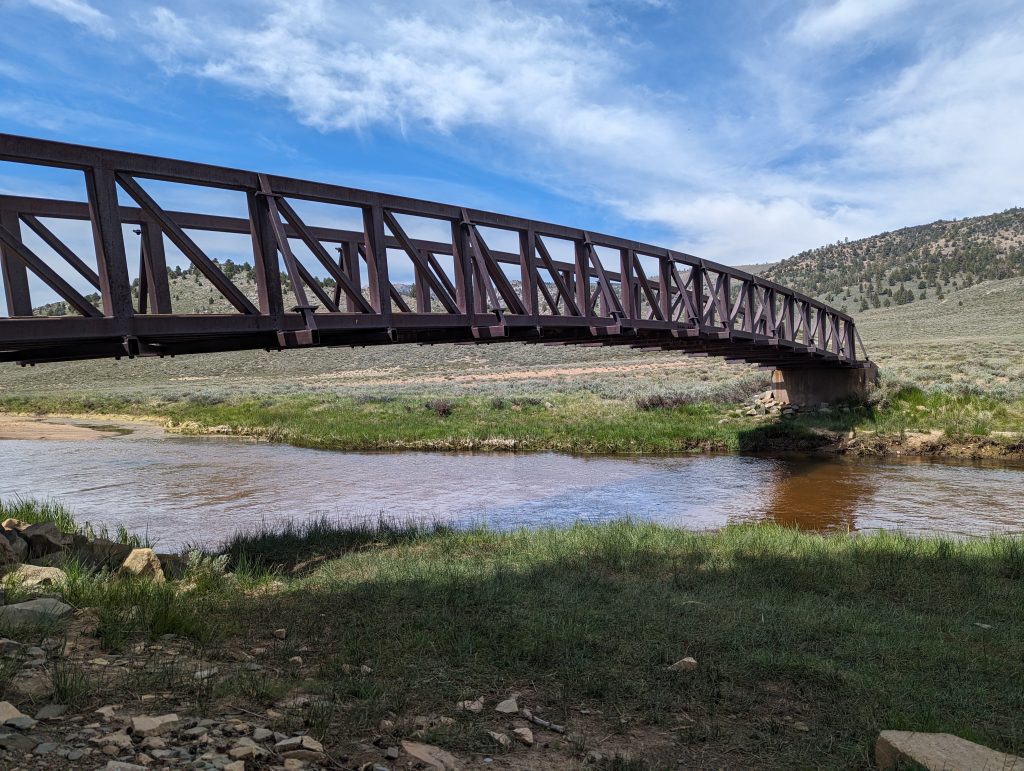
On a river that even runs a bridge, I take another break and meet some familiar faces from Kennedy Meadows.
After that I set off again to aim for a camp in about 5 miles. For today I have planned a short tour because I want to give my feet the necessary time to get used to the new shoes. It continues uphill through the forest and somehow I keep walking.
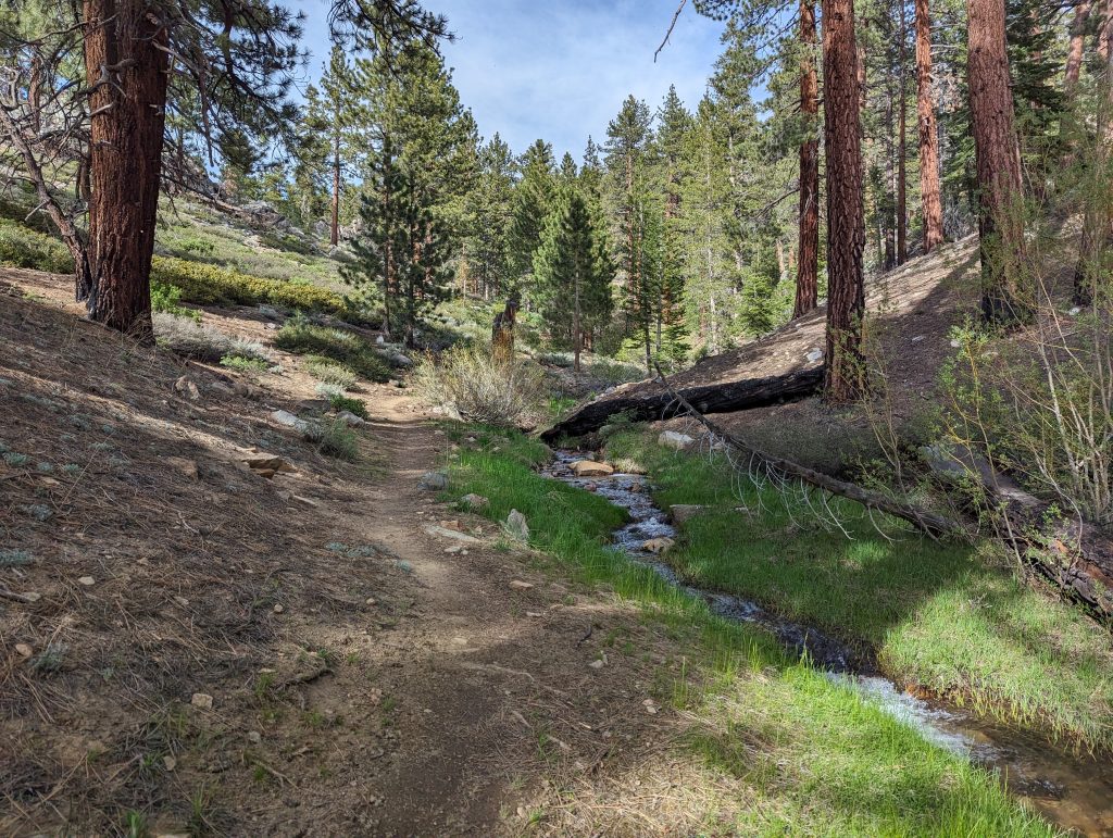
At a stream where I fill up my water again, I meet Ralf and talk to him. As it turns out, he is not only from Germany, but actually from Karlsruhe. As he tells me, a hiker from Bretten is said to be on the road, but I’ve apparently already overtaken them and will therefore no longer meet. Once again we wonder how small the world is. After a while we’re on our way again. While it’s only about 200 meters to the next campspot, I start another small climb because I’ve heard that there should be a place with a good view at the top.
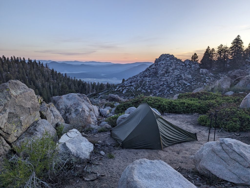
After a few more minutes, I actually arrive in a good place with plenty of space and the view is really not bad. The long climb today has led me up to almost 3000 meters above sea level. Actually, I had planned to hike only 10-15 miles today to slowly shrink the shoes. Unfortunately, I didn’t manage to rein and so in the end it was 21 miles with over 1600 meters in altitude on the ascent. After all, I still didn’t get any blisters, which I’m very happy about.
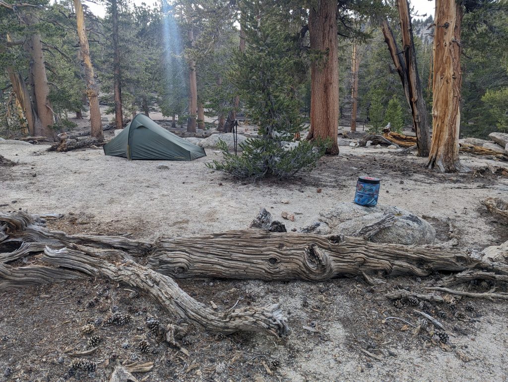
At the campspot, I meet Lucky, who has his trail name because he was bitten by a rattlesnake, but fortunately didn’t pour out any poison. As a precaution, he was still in the hospital, but was then able to leave it after just a few hours and continue his hike on the PCT. Since I already know him from the last few days, I sit down with him and we have dinner together. Actually, I wanted to have cowboy camps today, but since the mosquitoes bother me so much, I’ll set up my tent without further ado and then go back to sleep soon to recover for the next stage.
Day 38 – 34.1 km – Monday 03.06.2024
It looks like my body still has to get used to the height. I could sleep well, but my heart rate was significantly increased. At almost 3000 meters in altitude, I’m less surprised.
I get up at 6 a.m., pack up my tent and have breakfast. Then I’ll start again in good weather.
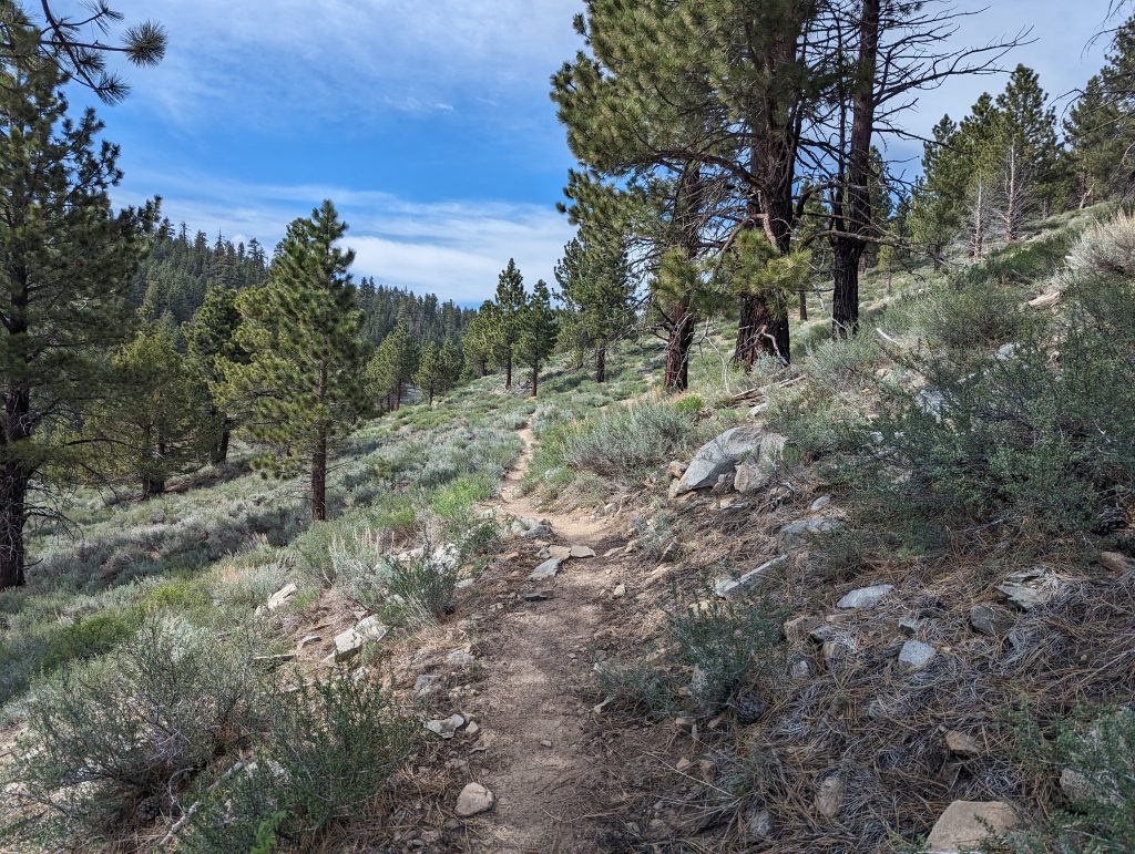
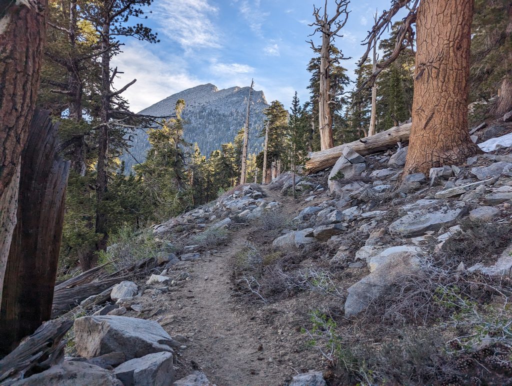
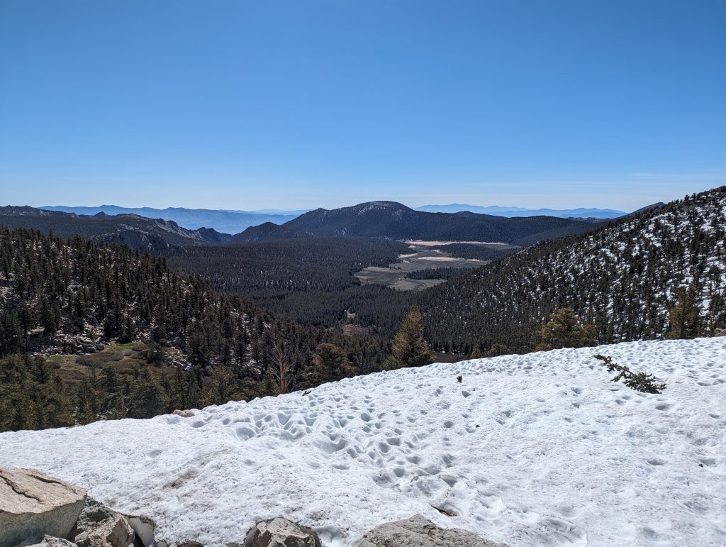
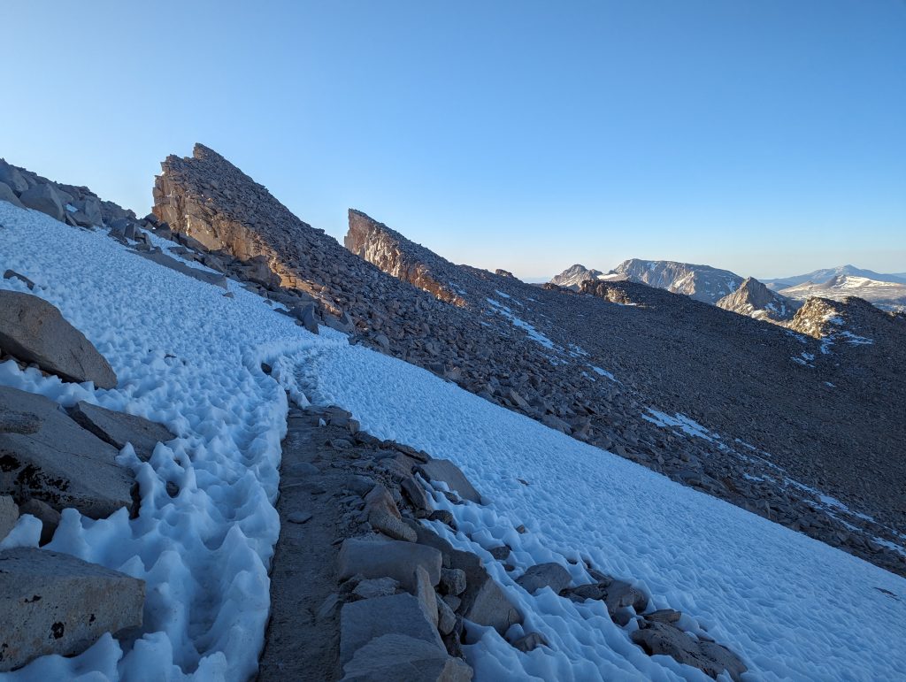
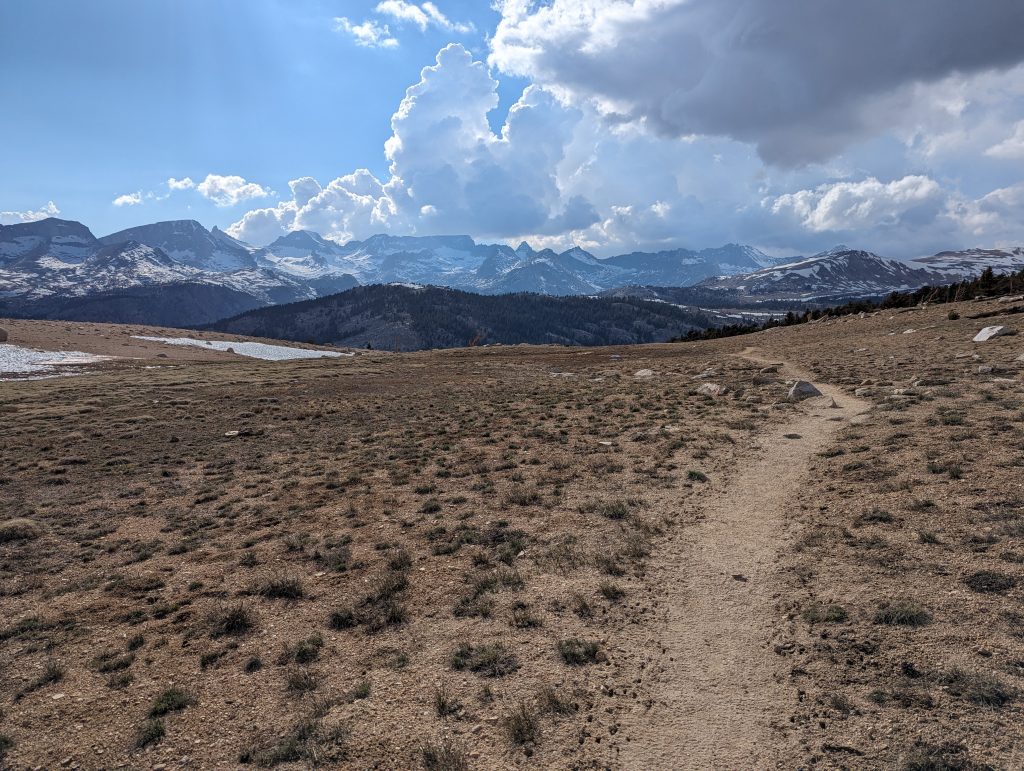
It goes directly uphill and after a short time I can see the beautiful landscape next to me. The path leads me up through the forest and soon I meet the first snow fields on the path. In the distance I can see higher, snow-covered mountains and the sight of them triggers joy in me, because I can hardly wait to finally advance into the higher altitudes.
But for me it’s going downhill for a long time. On the easy-to-run path, I can make quick progress and am about to be on the next climb.
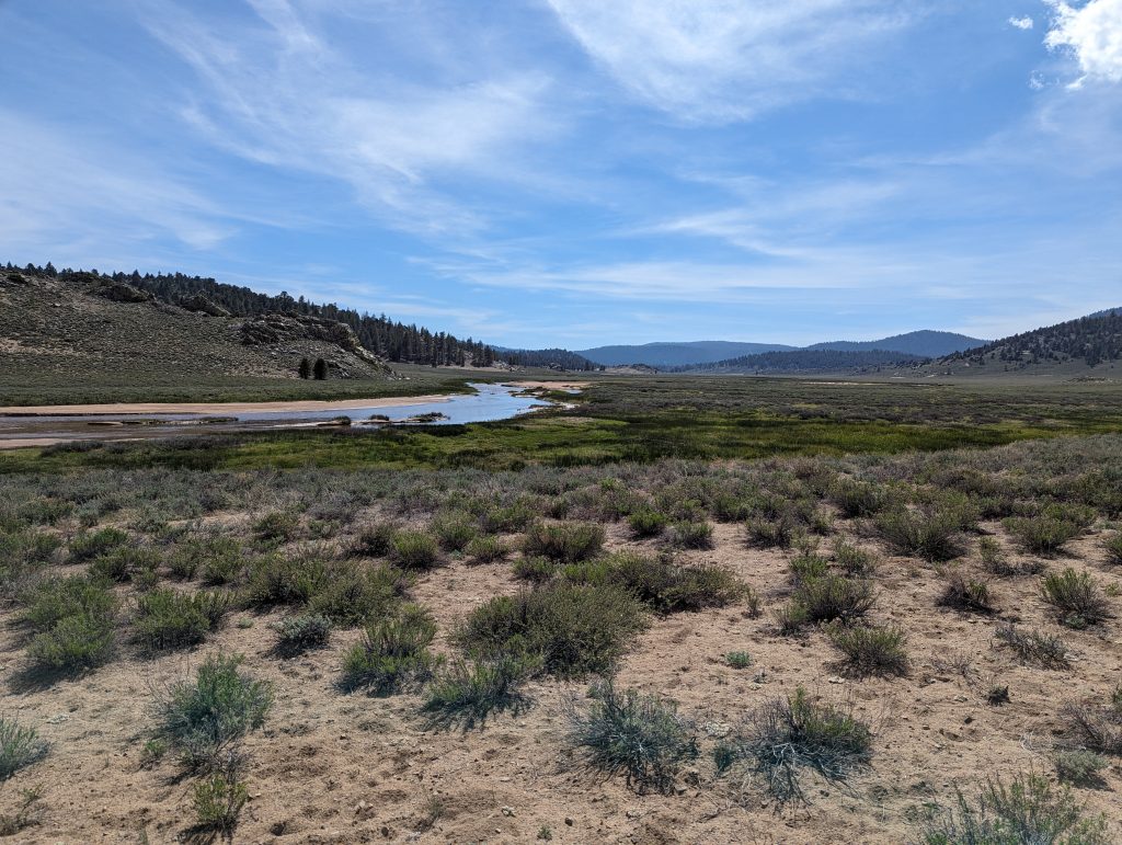
At a river I refill my water and talk to a 72-year-old American who started his second attempt this year. As he tells me, his son currently lives in Germany and in the Dobel. He is very pleased that I know this place in the Black Forest, since none of the Germans have been able to assign the small town. Again, you can see how small the world is.
The following climb is quite long for me. Apparently I have a small bladder on the heel of the new shoes, which slows me down significantly. Nevertheless, I keep running up and around 12 o’clock I almost reached the top.
When I see a suitable place for a lunch break, I turn off and rest my feet and my feet. With the meanwhile cold temperatures and the cloudy sky, I put on my jacket during the break so as not to cool down.
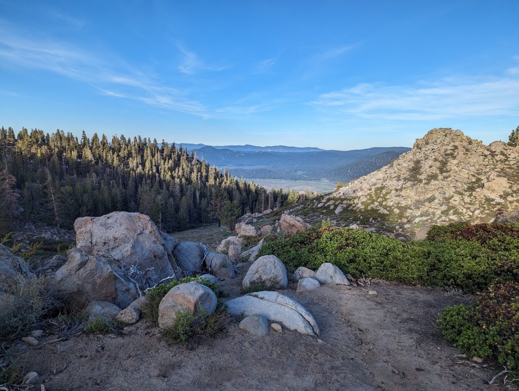
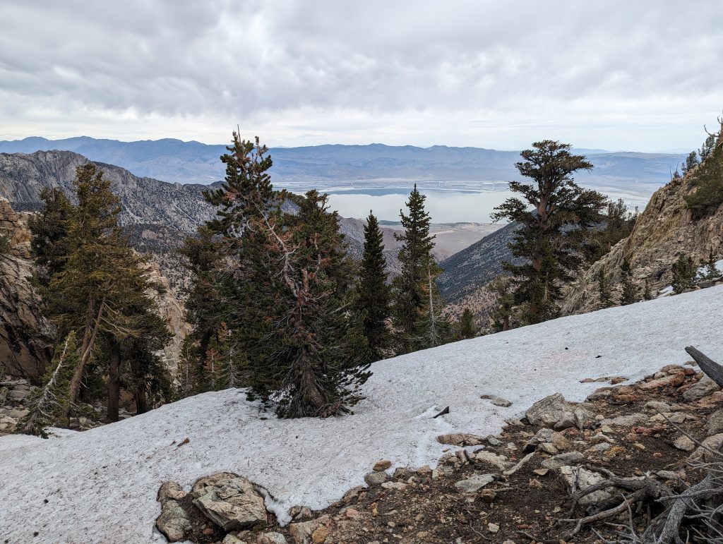
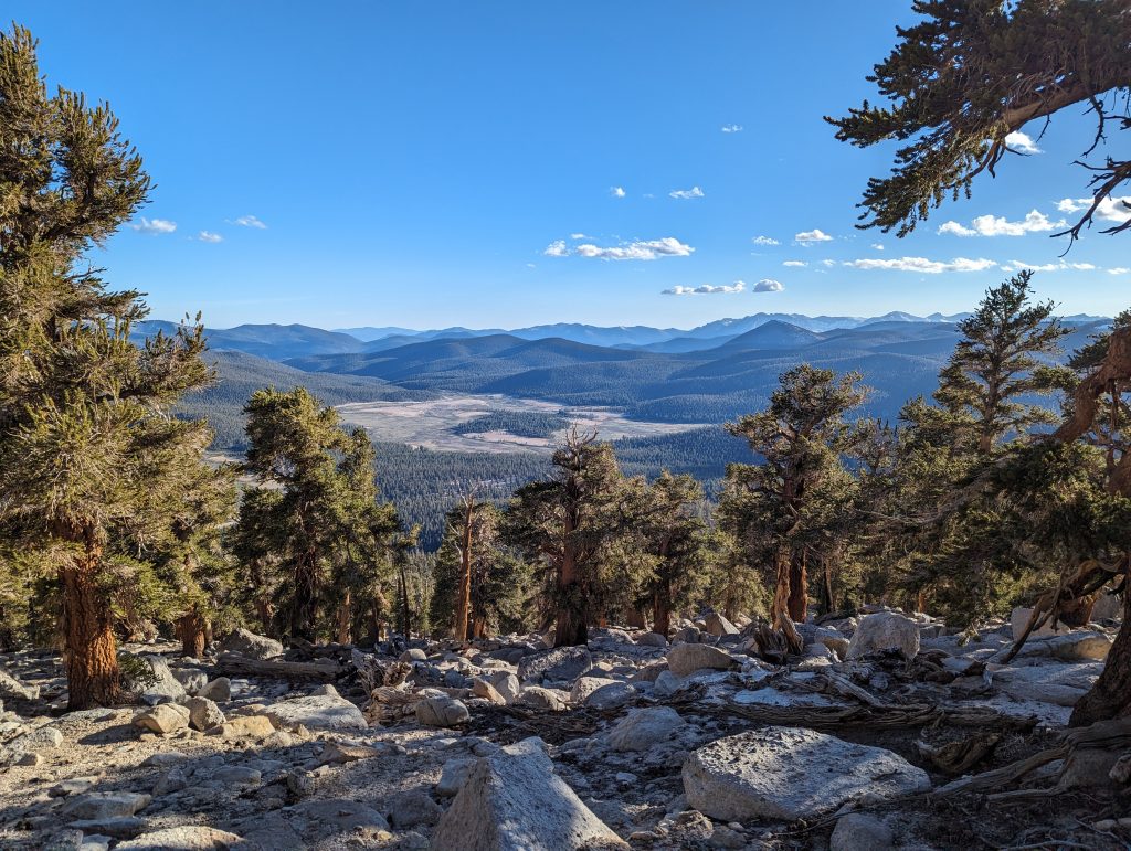
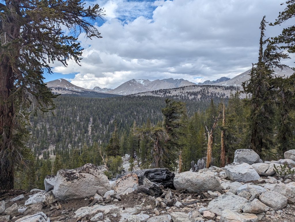
After a refreshment and a nap, I’m going to the last few meters of the descent. Soon I will reach a small pass from where I get a good view of the other side of the mountain range. In contrast to some other hikers who take a break here, I continue to walk uphill. About at the top point, I’m at least 3250 meters above sea level. But somehow it doesn’t feel like it at all, since even at this height trees are still growing here, which I’m not used to from the Alps and other mountains.
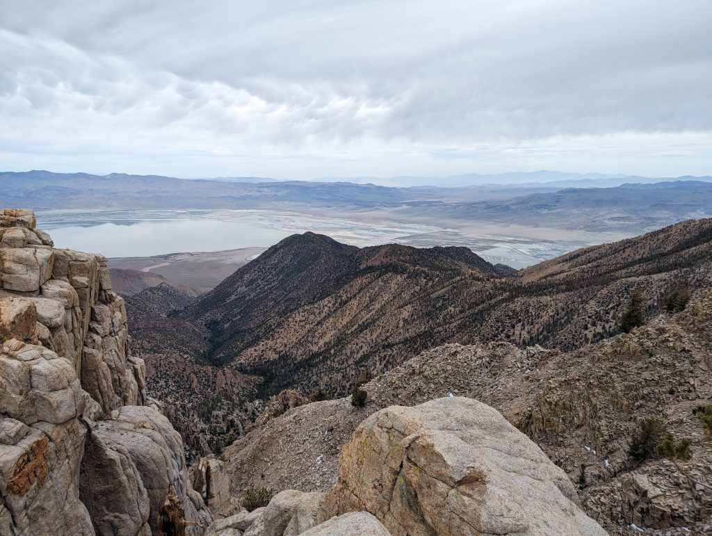
A short time later I get a good look down again.
From then on it’s going downhill for me and I’m making a little faster progress again. Apparently the bladder on the foot has already opened, because I no longer feel it and can therefore continue without pain.
When I’m at the bottom, it’s straight uphill again. In the afternoon, running is very easy for me and so I run up the mountain myself.
After 21 miles I reach a place in the forest where there are several suitable places to camp. I set up my tent and get fresh water in a nearby stream. Then I cook my dinner and rest in my tent.
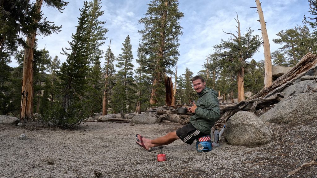
Because a worthy reader wanted to know what my bear canister looks like, I took a picture of it here.
Actually, it’s just a large container with a screw cap, but it has a safety mechanism. Similar to some medication doses to protect them from children. Although the bear can still smell the food, it cannot open the container itself. Since these are usually tested on Grizzly Bears, he should also withstand the power of a smaller bear. However, since the bears still try to get the food, it is best to put the container far away from the tent in the evening. Here is a symbol image. In real life I’ll put him further away.
It is also practical that I always have a small stool with me that I can sit on while cooking dinner.
I’m not really broken from the stage today. But since I want to descend into the valley tomorrow to replenish my reserves in Lond Pine, and there are only 7 miles left until then, running on it doesn’t make much sense. So I still have some distance to walk tomorrow before I have to hitchhike into town. I hope that around 8-9 a.m. there are more cars on the streets and someone is taking me with them.
Day 39 – 32.7 km – Tuesday 04.06.2024
Today I get up at 5:30 and pack everything up. Apparently I’m still late because the other hikers who stayed here are all gone.
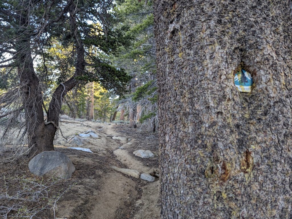
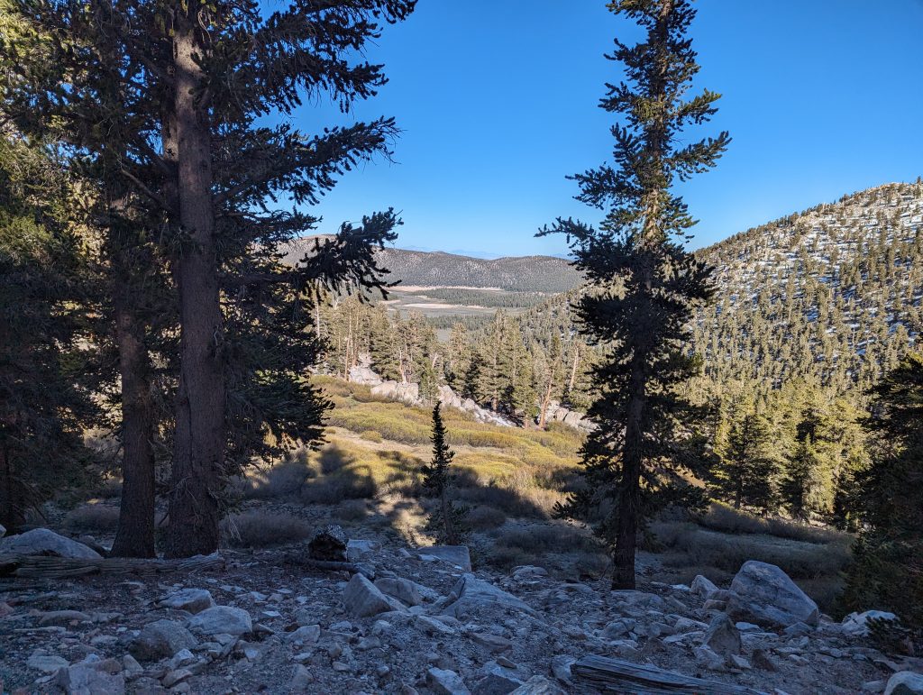
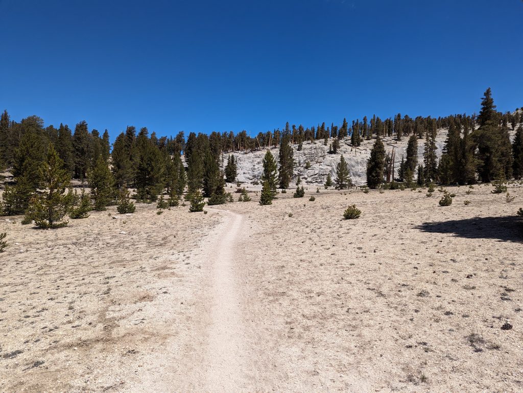
For me it goes straight up the mountain. It goes through the forest most of the time and the temperatures are very pleasant. Again and again I get a nice view and can also walk over smaller snow fields in between. After all, these are neither particularly large nor really slippery and so I’m still making good progress.
After about 11 km I come to the junction, which leads me down into the valley to a road. It goes downhill for a long time and further down then quite relaxed through the forest.
After a total of 18 km, I stand on the road. Unfortunately, there really isn’t much going on here and so the hitchhiking becomes a test of patience again. In the first half hour, a car drives past me, but unfortunately it is full. So I sit on the side of the road for a long time and wait for someone to take me with me.
I use the time to write a diary and eat a little something. In retrospect, I would have packed more food to walk through the entire route to Bishop. But since I didn’t know how fast I was going here, I only have food for three days with me and therefore have to go to Lone Pine to replenish my reserves there. After a while, a car stops and takes me with me. To my delight, it’s an older hiker I met in Kennedy Meadows a few days ago. Since he only wants to do the Sierra at the end of the summer to avoid the snow, he is currently providing other hikers with food. It’s an interesting ride where we talk about different tours and areas. He gives me some tips for areas that I would like and that I should definitely visit. After about 45 minutes we arrive in Lone Pine and he lets me out at the supermarket.
There I buy more food and then run to an outdoor shop. There is a small area for PCT hikers where there are sockets, water and shade. In contrast to the mountains, it’s pretty warm down here and I’m all the happier for the shade. Also, I meet some other people I know from the last few days. We rest together in the shade, quickly buy something to eat at Mc Donalds and then drive back to the trail together with a kind of shared taxi. The journey is carried out by an older pensioner who brings hikers back to the mountains for little money.
When I got back on the trail, I say goodbye to the passengers because they have to go to a starting point differently from me. I did a few miles more this morning and I’ve come down a pass that is already further back.
So for me it’s going up the whole Cottonwood Pass from this morning. In total, it is almost 4 miles with a few meters of altitude difference, which is quite exhausting with the heavy backpack.
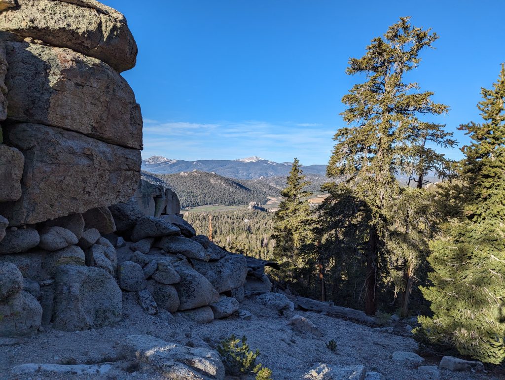
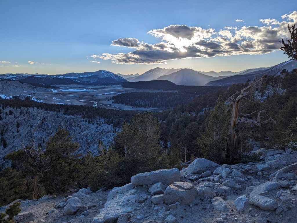
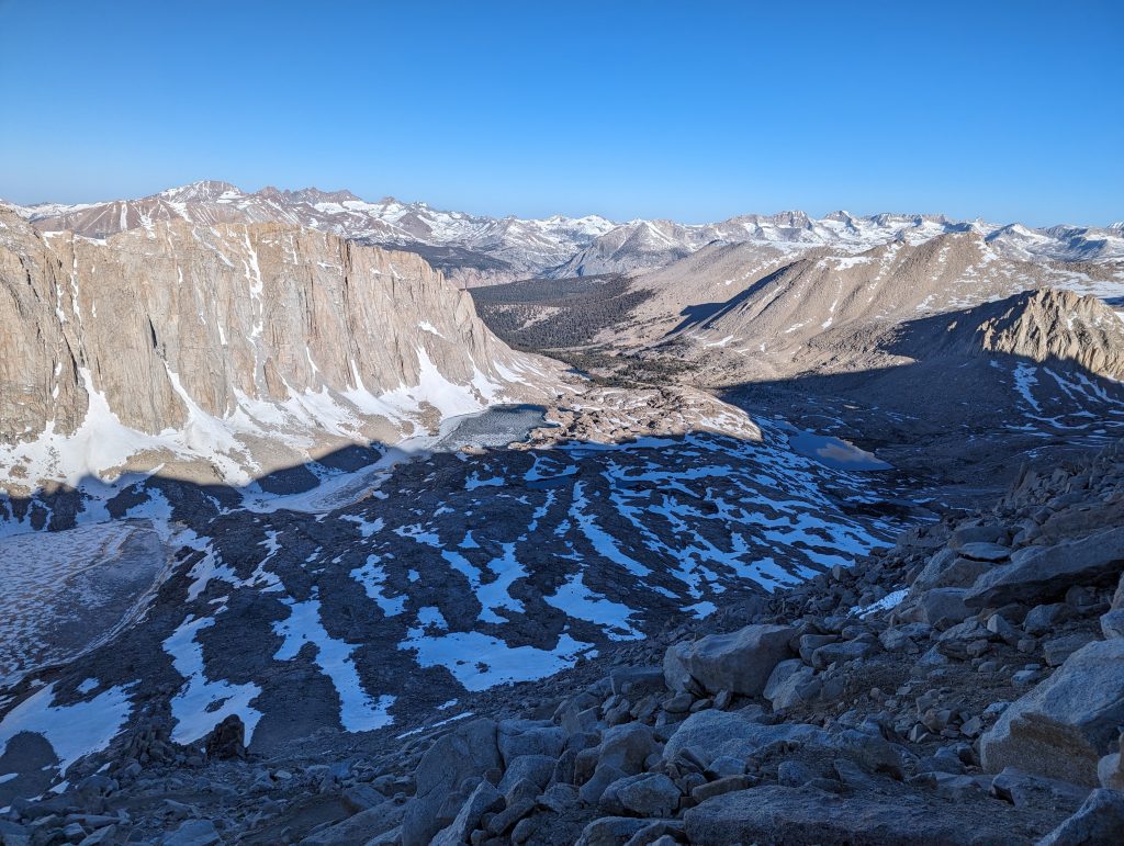
After a while I reach the actual PCT trail again. Since the sun hasn’t set yet and I have some time left, I decide to do a few more miles today to have a short day tomorrow that I want to use to rest before the next day on Mount Whitney, the highest mountain in the USA outside of Alaska, go. So I keep walking in the sun setting. This makes the landscape look particularly beautiful again.
As I climb over a small ridge and hike down on the other side, I get a fantastic view of the mountains in front of me. The low sun shines through the clouds on the mountains, which looks really impressive. Unfortunately, it comes out less nice in the picture than it really was.
I keep running and it’s getting dark now. Only around 8 p.m. I reach a campspot in the forest. There I cook something to eat quickly and then lie down in my sleeping bag to sleep.
Day 40 – 20.3 km – Wednesday 05.06.2024
Today is a short day for me. In the morning, I eat my breakfast and pack everything together. Then it starts right away.
The path leads me quite relaxed through the forest downhill and in the background I can see great mountains again.

In the morning, the first really river crossing comes towards me. In the forest, a mountain river carries quite a lot of water and I can’t find a place where I could get to the other side dry. So I take off my shoes and set off barefoot. The ice-cold water is just above my knees and is a nice cool down in the morning. After all, the current is not too strong and with my hiking poles I have a secure footing in the water to be able to cross the river safely. After a few seconds I arrive on the other side, where I then dry my feet and put my hiking shoes back on.
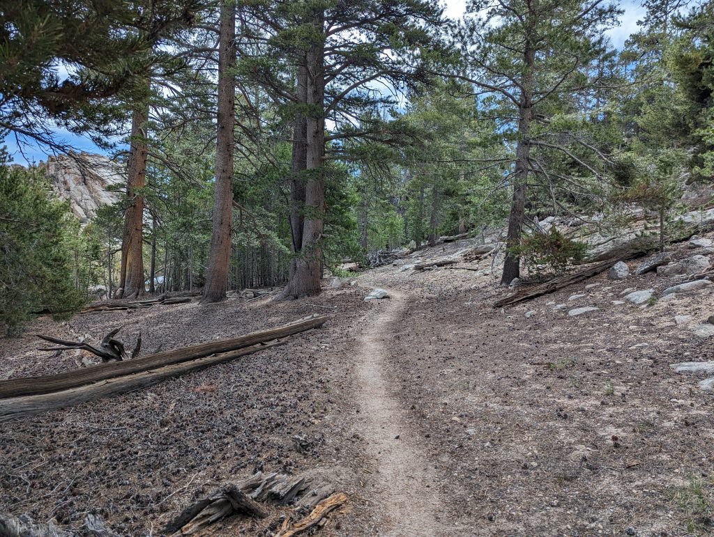
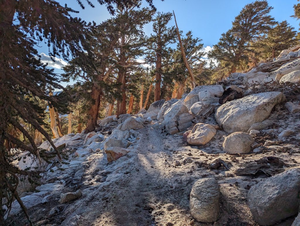
After that, it’s uphill for me. I leave the forest and from then on I’m out in rock, with the path still surrounded by trees.
In the warm sun I keep walking up. After a last pass, it goes down again and in front of me I can already see the higher mountains.
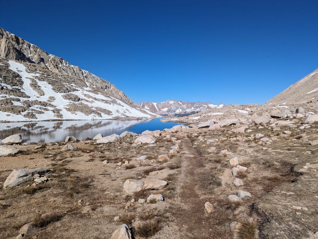
The last few meters are relaxed along the water before I reach the targeted camp at around 12 noon. Here I set up my tent and rest. For other hikers who have already climbed Mount Whitney today, I find out how long the climb takes. At 6 o’clock in the evening I go to sleep because I’m already starting again tonight.
Day 41 – 38.9 km – Thursday 06.06.2024
I get up at midnight, drink another liter of water and get ready.
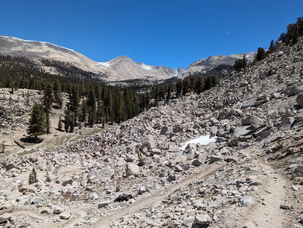
It’s warmer than expected and so I set off in shorts and a headlamp. On the way out of the camp, I meet another hiker with whom I run for the first few hours. After crossing a river, we continue back in the valley in the darkness. Since we can’t see much outside the range of the headlamp, I can’t tell you much about the way. At first it goes slightly uphill along the water. Then it gets rockier and it goes more and more often through small snow fields. Luckily, in the cool temperatures of the night, they are still frozen and so we can just walk over it. In between, however, we always have to look for the way, since finding the way in the dark is not that easy. Even if we can’t really see much of the landscape, hiking is really fun.
Since it is a very clear night, we always marvel at the starry sky above us. Even the Milky Way is clearly visible to the naked eye, which is really fascinating.
In the light cone of the headlamps, it goes up and further up. After a while we meet other hikers that I know from the last few days. For a short time we walk through the snow together. When we’ve already gained a bit of altitude (about 3900 meters) and it’s serpentine up the steep slope, I pulled away from the group and walk ahead. Soon I’ll overtake another group that has started a bit in front of me. Since I enjoy running and I can cope well with the high-altitude air, I almost run up the mountain and can always see the headlamps of the others under me.
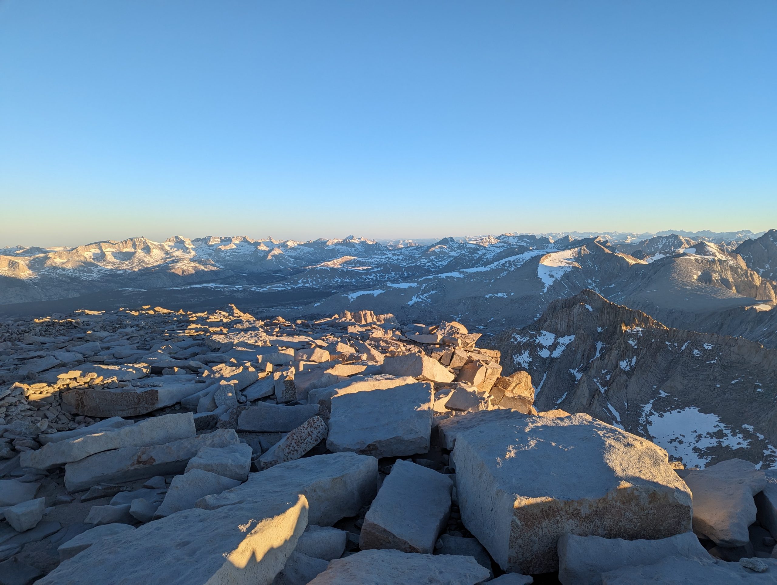
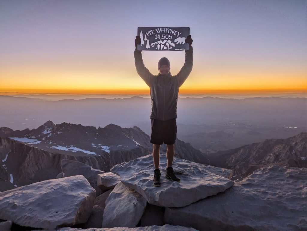
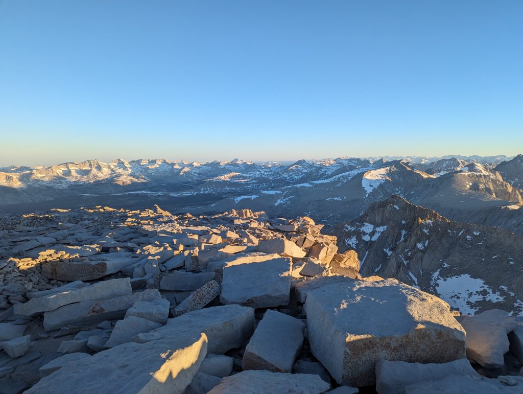
It keeps going up and at the end a bit around the mountain, to climb it on a last climb. After almost exactly 4 hours and 30 seconds, I reach the summit of Mount Whitney at 4429 meters above sea level.
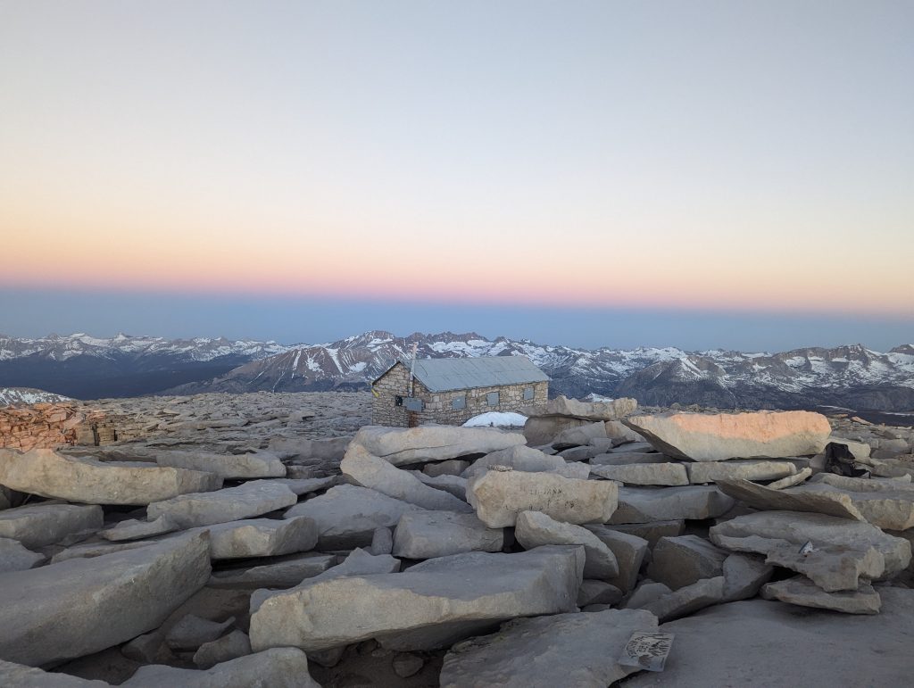
Since it’s just 4:20, I have to wait a little longer for the sunrise and I can’t see much else. Only a small light on the horizon shows me where the sun is slowly rising. I sat down in a sheltered place and cover myself with my sleeping bag. Then I treat myself to a piece of Toblerone as a summit prize, which I really enjoy.
After a while it gets a little brighter around me and I can see the first outlines of mountains behind me. But I only become aware of the really extent of the fantastic panorama when it gets a little brighter. After some time, the other hikers arrive and the last one makes it up on time for sunrise. After we have all taken a few summit pictures, we marvel at the fantastic surroundings for a long time.
The Sierra looks really magical and I can hardly get enough of it.
I’m making myself a morning, warm coffee that’s really good in the cold temperatures.
One of the hikers finds a small bottle of whiskey in his backpack and so at half past four in the morning we toast to the summit together. While the others start the descent again at 6 a.m., I look at the landscape for a few more minutes and then start the descent.
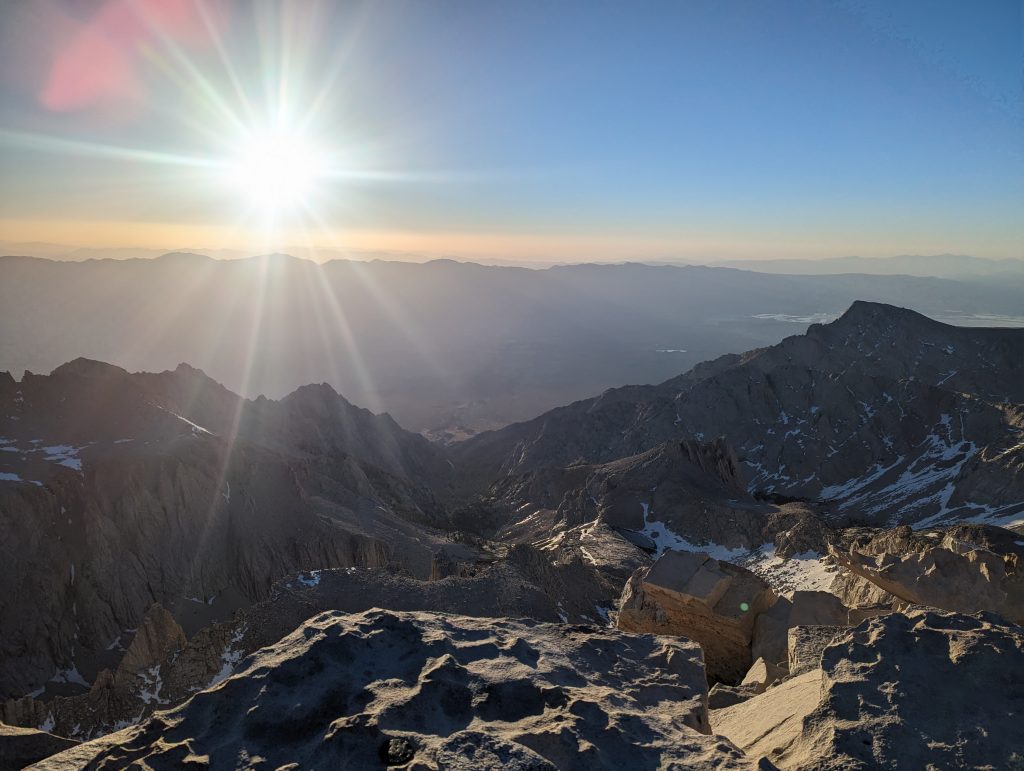
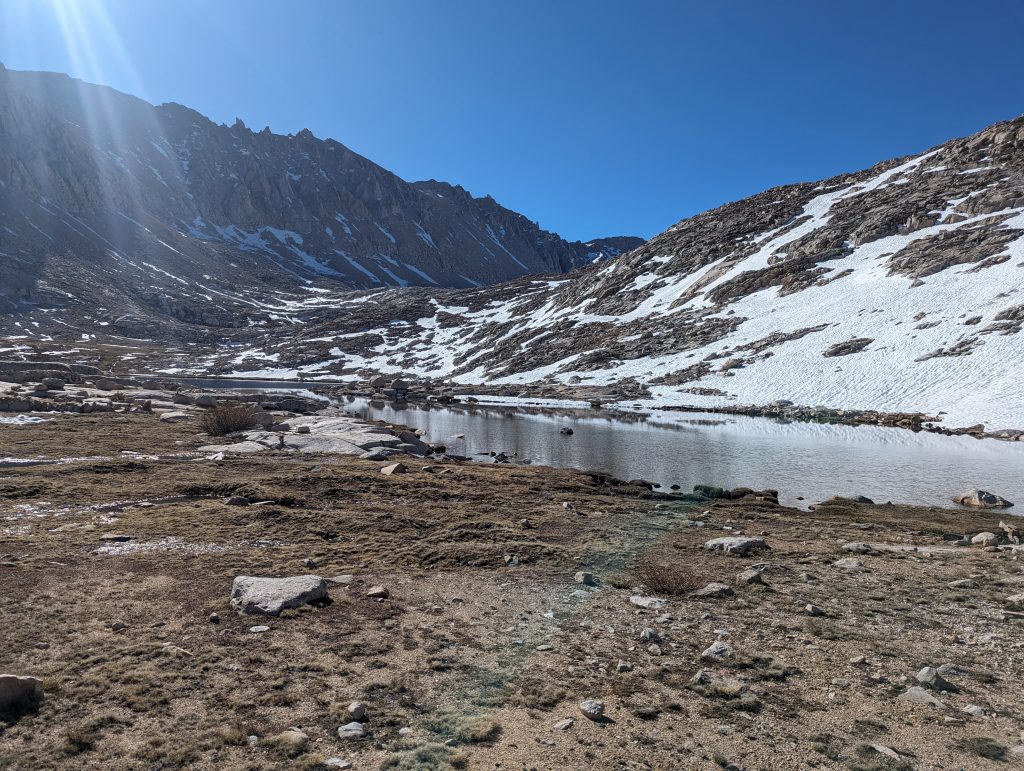
This is really interesting, because I can now admire the fantastic landscape through which I walked in the dark this morning. I couldn’t imagine how beautiful the surroundings are and so I also take some pictures when I walk down. First it goes up the slope, then through snow fields and finally along lakes.
Since I’m on the move with quick steps, I’ve soon overtaken everyone again. At a stream I slip on an ice surface and then lie briefly on the path. Although I had noticed that my main leg was slipping away, I couldn’t stop the fall and literally fell on the side. In addition to a bruise on the thigh, which is likely to come, nothing bad has happened and so luckily I can continue to walk.
After about 2.5 hours I reach the camp again, where I left last night. In total, it took me almost 6.5 hours for the ascent and descent. After climbing some 3000 and in Mendoza a 5000, I can now add a 4000 to my list with the successful climb of Mount Whitney.
In the camp I eat a real breakfast, wash some clothes and then go back to sleep for a long time. Later I write my diary and rest a bit. Since the Forrester Pass, the highest official point of the PCT, is another strenuous climb ahead of me and I want to do this morning in the morning to take advantage of the frozen snow, I’ll continue in the afternoon.
Around 2 p.m. I pack everything up and leave the campspot. On the small river that flows next to the camp, I meet two hikers that I’ve met more often and with whom I’ve been sitting in Kennedy Meadows. You’re asking me how it was on Mount Whitney and what the conditions are. Both are behind me for a day and want to climb the mountain tomorrow. I will describe the route to you and how much time you have to take into account. Then we’ll talk about the further route, because there are also a few things to consider there. After about half an hour I really set off.
It’s going straight back uphill and I notice right from the start that I’ve already made some efforts today. After all, the way is quite easy to walk and I always get a great view of different mountains.
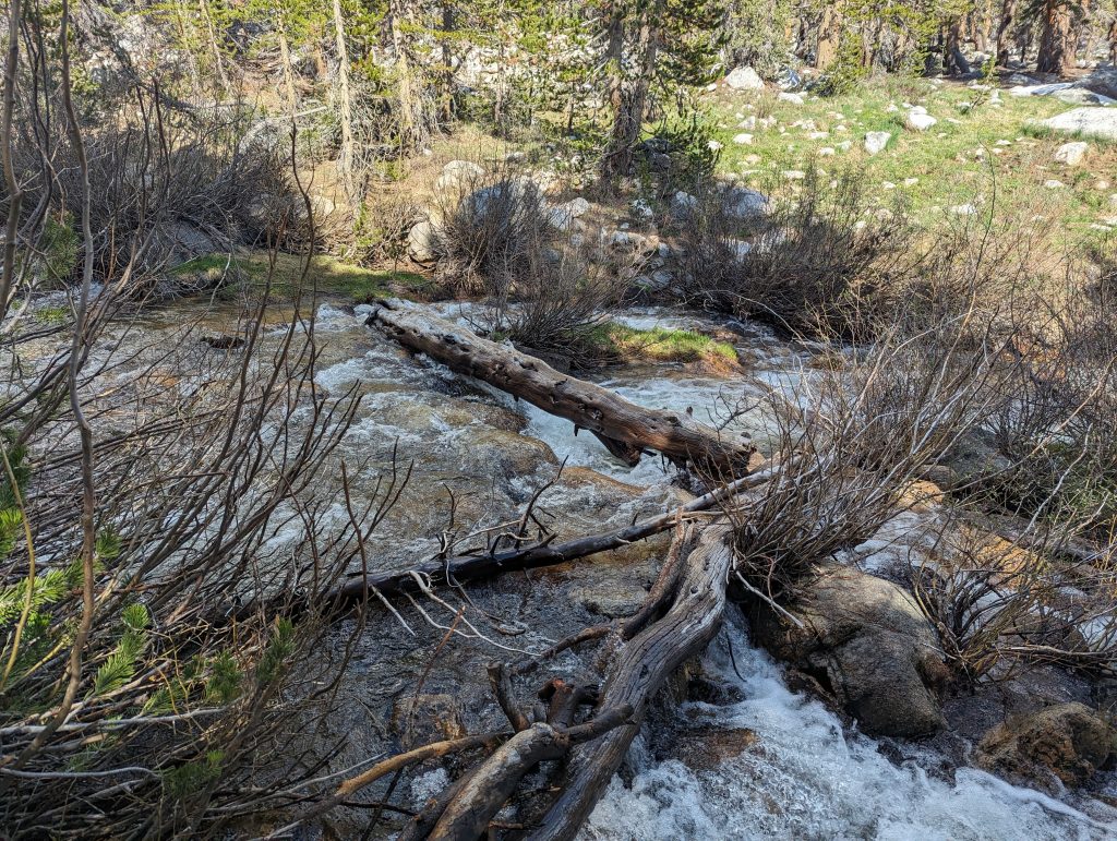
After some time there is a river to cross again. The ice-cold water is about knee deep here too, but it doesn’t flow particularly quickly and so I can get to the other side well. After I put my hiking boots back on, I continue uphill through the forest. After another ascent and descent, I stand in front of a river again. This time the water not only looks deep, it also shoots down the mountain at high speed. Crossing it doesn’t seem possible to me here. So I walk up and down the river a bit to find a suitable place to cross. The best I can find is a tree trunk that lies over the river. So I carefully grope my way on the wet and slippery wood so as not to fall into the rousing water. After my balancing act, however, I reach the other side with dry feet and can continue my hike.
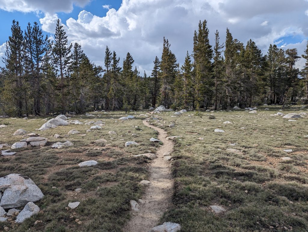
In the meantime, I’m pretty sure of the day’s exertion and I’m really exhausted. Nevertheless, I’m slowly running on as I still have a few miles to the next campspot with water. It goes through a meadow landscape and again I get a beautiful view of the surrounding mountains.
To my regret, it goes up again afterwards and meanwhile the muscles hurt slightly. For this I am comforted at the top of the mountain with a breathtaking mountain panorama.
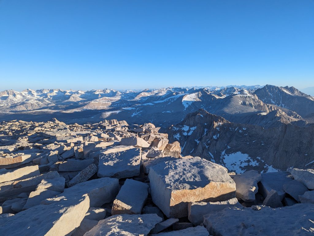
I enjoy the sight so much that I forget the pain and just run in front of me happily. On the last few miles it goes downhill and I enjoy the beautiful view again before I finally reach a campspot. Exhausted, I set up my tent, cook a large portion of pasta and then go to sleep straight away. The day was definitely one, maybe even the most strenuous day so far. After all, I managed almost 39 km and climbed over 1800 meters in altitude, which is quite exhausting here in the mountain air. Nevertheless, it was also one of the most beautiful days on my current hike. The many impressive mountain panoramas have always amazed me today and the climb to Mount Whitney alone was an adventure in itself that I will certainly not forget so quickly.
Survey
Since my last blog post, I haven’t done a lot of distance on the PCT, but made a nice detour to Mount Whitney, the highest mountain in the USA outside of Alaska.
Leave a Reply